
The report on Cumulative Effects for the Trent River Watershed is out! Many thanks to Dave Weaver, Dave Daust RPF, and Scott Scholefield RPF for their work on this report! To access the full report, click HERE. The executive summary follows:
Background:
The Trent River Watershed Cumulative Effects (CE) Assessment project is the third in a planned series of watershed health assessment projects undertaken by the Beaufort Watershed Stewards (BWS). The first BWS watershed assessment project in 2021 involved four local watersheds (6) , basically utilizing an older protocol – the 2001 BC Coastal Watershed Assessment Procedure Guidebook (4).
In 2023, the second BWS watershed assessment project was completed for the Tsable River (7). This report used a new watershed assessment protocol published by the BC Government, titled: Interim Assessment Protocol for Aquatic Ecosystems in British Columbia – Dec 2020(3) (further referred to in this report as the “Protocol”). This is a very comprehensive, made-in-BC procedure, that includes complete thresholds for six core watershed health indicators. The BWS has embraced these procedures of the Protocol for this 2025 CE Assessment of the Trent River’s aquatic and hydrological function.
Methods:
The procedures and thresholds listed in the Protocol for the six Core Indicators (listed below in the table), were followed in this report, and were determined by using primarily Geographic Information Systems (GIS) technology, augmented with vegetation interpretation of 2023 satellite images. A percentage of only a few Core Indicator metrics were ground verified- 64% of tree heights for Peak Flow, 17% of GIS identified Stream Crossing and 15% for imagery identified Riparian Disturbances.
Results:
The following is a Summary Table, listing the six Core Indicators’ final values for this Report.

Table 1: The Six Core Indicators’ final values assessed in this Report. High values are shown in red.
Using the hierarchy process of the Protocol and the six Core indicator values identified above, the overall Trent River watershed risk rating was determined as having a HIGH potential of negative impacts to hydrological and aquatic ecosystem function due to the cumulative effects of industrial development(3). The Protocol suggests that assessed watersheds with a resultant high-risk rating should further be assessed via a more rigorous analysis by qualified professionals – which is consistent with recommendations made by Dr Alila (1, 2) and also by the Joint Professional Watershed Practice Guidelines document, published by the Forest Professionals of BC (FPBC) and the Engineers and Geoscientists BC in 2020 (8).
Recommendation:
Therefore, due to the high-risk rating of the cumulative effects potential impacts within the Trent River Watershed, further professional assessment is recommended to be undertaken.
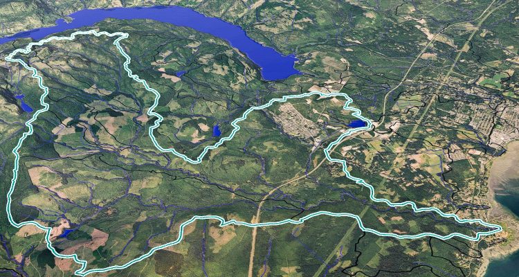
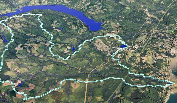
Access 3D watershed maps at www.beaufortwater.org
Thank you for your thorough work Dave and Dave. Speaking from an impartial perspective It makes sense that assessments like this should be conducted before permits or licences for development are granted by the Government.