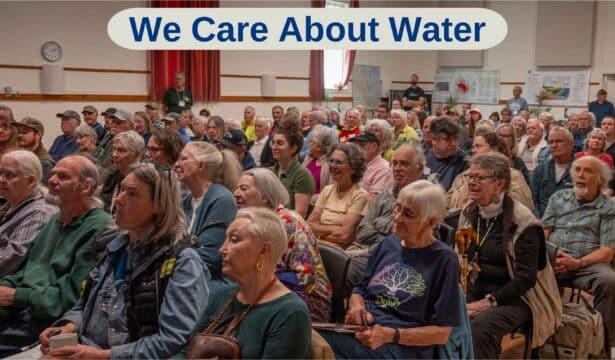
The Beaufort Watershed Stewards (BWS) want to promote the health and ecological integrity of watersheds on the east side of the Beaufort Range. They value evidence-based decision making, scientific rigour, and open collaboration. Who are they? They are your neighbours and your friends. With help from university students and their professors and advisors, and support from the CVRD, the RDN, and local businesses, they work to understand the land and the water that flows through it. Most residents in the Beaufort watershed depend on well water. Our ability to turn on the tap and see water flowing is of vital importance to us all. BWS is trying to address this concern. On April 26 the Fanny Bay Hall was packed for the presentation “Local Aquifers: What Our Data Reveal”. A kind and generous blessing by Elder Tami Compton of the K’omoks First Nation opened the meeting and Lynne Ray served as emcee.
The first speaker, Mike Wei, is a physical hydrogeologist and was the technical expert for the province when the Water Sustainability Act was being developed. He presented a plexiglass model of an aquifer in cross section that showed how deep wells, shallow wells, pollution (i.e. failed septic systems) all interact within the various layers of the aquifer. The model gave a visual representation of the underground world showing how water moves through the layers of sand, gravel, clay and fractured rock. He also explained that well drillers submit reports to the Province detailing these different layers encountered while drilling. These records are important for developing a picture of the geological layers that make up the aquifer. Dr. Wei was one of Kate McMillan’s advisors on this project.
Next, Mark Lake discussed sounding techniques that allow us to explore the geological layers below our feet. Mark attended school in the UK and graduated in Earth sciences with a background in Geology, Geography and Applied Geophysics. He started volunteering with BWS in 2020 and in 2021 launched the aquifer mapping project that he went on to describe. He showed bedrock maps that have been developed by this technique and will be submitted to the Canadian Water Resources Journal for publication. His team’s work in the Fanny Bay area has greatly refined our knowledge of Aquifer 419, but also many other areas up and down the eastern side of the Beauforts.
Kate McMillan gave the presentation that we all came for. She has just graduated from the University of Victoria and is obtaining an honours baccalaureate in Physical Geography from the School of Earth and Ocean Sciences. She presented her work characterizing the ground water in Fanny Bay and Aquifer 419 in particular. She explained the mapping process and thanked the well owners who allowed their wells to be measured. Her work estimates an upper limit of one thousand cubic metres (one million litres) per day. With a population of one thousand people, this works out to a thousand litres per day available per person, five times what the average Canadian uses. She noted that many people use water for irrigation but also pointed out that much of the water used in irrigation is returned to aquifer. Kate reported that the data collected so far show no signs of saltwater intrusion in our area.
Mike Mesford, the president of BWS, spoke about the implications of Kate’s work and what needs to be done next. The seemingly good news is offset by uncertainty. All three presenters noted the need for more studies, however, BWS does not have the capacity to do more research without an influx of volunteers. The other point Mike made is that while we may have enough water, it may not be accessible to everyone. Shallow wells can still run dry at the end of a long drought and climate change may make things worse. Conservation is still very important.
Thanks for providing us with a well written summary of the event.