Category: <span>Reports</span>

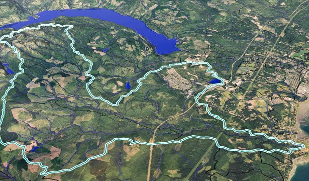
Mapping the Trent River

BWS volunteers had great fun suited up in their hip waders out in the Trent River. We were collaborating with Arin Yeomans-Routledge of Astraea Consulting to map the lower portion of the Trent River. Volunteers walked the creek, noting creek bed geology, riparian status, salmon access and obstructions, and general …

Groundwater Connections

This is a publication by the Regional District of Nanaimo (RDN) reporting on the state of local aquifers. The aquifers in the southern portion of the Beaufort Range fall withing the RDN jurisdiction. This 12-page document provides an excellent overview of groundwater processes, and threats due to climate change and …

Watershed Health Report Card

Updated: 26 October 2024 The 2021 Beaufort Watershed Stewards (BWS) Hydrological Health Report Card presents initial data from watersheds on the east side of the Beaufort Mountain Range. Data were gathered in the summer of 2021 and included: equivalent clearcut area percentage, total area harvested, road density, number of stream …