
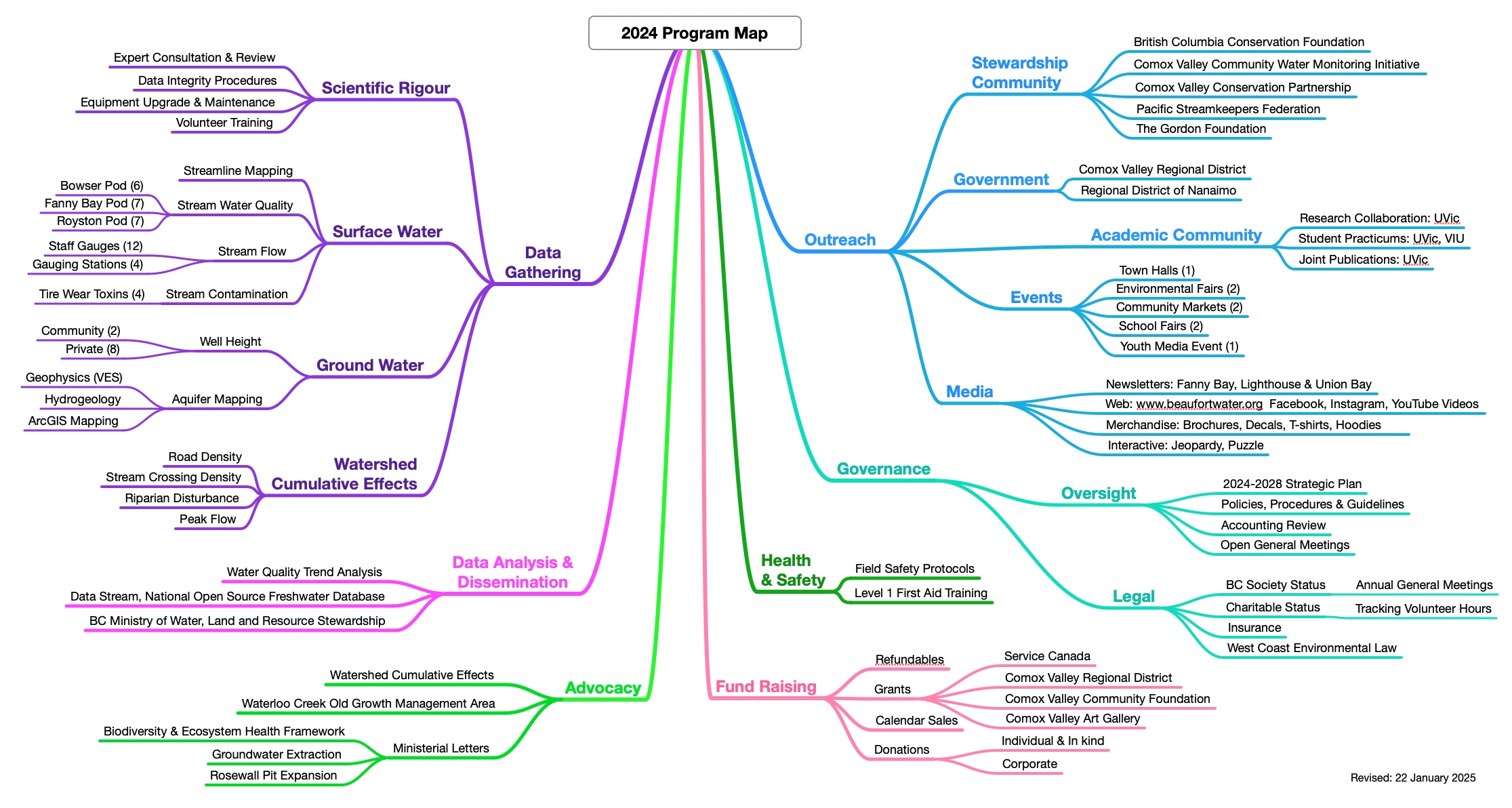
Our Program Map summarizes our six science-based programs:
- bi-weekly monitoring of surface water quality in 20 creeks,
- flow monitoring at gauging stations (2) and with installed staff gauges (12)
- continuous monitoring of well water height in selected private and community wells,
- monitoring for tire toxin contamination in streams before and after rain events–lead by BC Conservation Foundation,
- assessing cumulative effects of human activity in selected watersheds. Five watersheds completed.
- mapping aquifers using vertical electric soundings, hydrogeological data and ArcGIS mapping
Outreach, fundraising, governance and health & safety round out our full slate of activities. Our amazing skilled and committed volunteers keep all this work going!